|
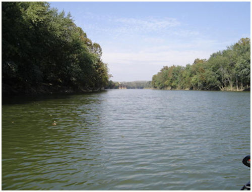
The Green River. by jrd on 5/29/07. Greeting and a Good Day to you. Hope things and events are going to suit your fancy and that the world is treating you better than you expect. From this end of the World, all is well, and every day is a joy once the aches and pains of the night are under control. Please scroll the main page down for a "Selection Block". Click on the block of your choosing to be taken to that particular page of the "Green River" Series. When you are finished with the page that you selected, please click on the "Back" button. Hopefully, you will make another selection and view another page. When you are ready to return to the starting point, just click on "Home". You may find more than you ever wanted to know about the Green River. Welcome to the "Green River" Series of the Rockport/Echols Web Site. If you have ever seen the Green River in the summer and fall months, you can surmise why this old river was named the Green River. This deep emerald green color of the river leads credence to its name. Ah, but have you seen it in the periods of high water. The color of this river can soon turn chocolate brown and just as easily could have been called the "Brown River". Local lore, and all of us as kids, were told that the Green River was named after its color. According to some local historians, the best information is that the Green River, minus the "e", was actually named for Revolutionary War hero, General Nathanael Greene. I, for one, am not going to try to convince those that have been taught the river is called the Green River, from its green color, that it may have been named for a Revolutionary War General. To most of the people in the world, this old river is unknown and unimportant. To a few, it was a very important part of their youth. To me, it was very special. We learned from this river. We were taught how to swim, how to hunt and how to fish. We were taught patience just by being associated with the older ones in, or on the river. We were taught leadership and became a leader to those that were younger. Every youth that ever spent a summer on the river reached levels that would help him later on in life. Each youth knew how far he could swim, how long he could stay underwater, how far he could throw a rock or piece of mud. There were specific diving and jumping platforms where one could either jump or dive from that platform into the river. The highway bridge was the ultimate jumping point and only a few kids ever made that jump. Most of the kids reached a point where they could either dive or jump from the "Middle Pier" of the Railroad Bridge. We all shared in fun and having a good time, but we also saw death. Accidents and drownings do and did happen. Most of us were fortunate and most of us returned home at night. For a youth to be told that he needed more exercise in those days was just not going to happen. There was just not very many overweight kids. It would be a blessing if the youth today could find the river like we found it, but so much for wishful thinking. We can dream. I have tried a new type code for the "Fish and Swim" page. You will see a "Fish and Swim" button when you scroll down. I am hoping that it will work. I have a background of a river with a "Text Box" to the upper right. The "Text Box" should lighten up so not only the river can be seen, but the text can be read. Look closely and you should see some bluegills swimming to the left and below the text box. Please let me know if it works for you. I have aligned the "Box" a certain distance from the right, thus if your screen resolution is not the same as mine, you may see a different graphic that what is presented. At that, You still should be able to view the text box and hopefully the fish. See you...... jrd |

|
